Thursday, August 6, 2015

Pagosa Springs, Colorado

We will be spending the month of August in the Pagosa Springs area.  Our campground setting is relaxed and very comfortable.  It's located about 10 miles outside of town, in a canyon, on the Blanco River.  We have good campground wifi but no Verizon Cellular Service. 


We have explored a little of the area since our arrival on August 1.  The town of Pagosa Springs
seems to have a lot to offer visitors and tourists.  There are museums, interesting shops and a new Walmart.  We cannot wait to get out on some of the Jeep trails, try out their breweries and even the hot springs.
We enjoyed our short hike up to Treasure Falls.

Lobo Overlook is located on Hwy 160 at the summit of Wolf Creek Pass.

View, looking westward, from the top of Lobo Lookout. 

Eastward view from Lobo Lookout. 
Ron's pointing in the direction of Pagosa Springs.
A passing rain shower and some sunshine made the alpine wildflowers sparkle.  This is Lanceleaf chiming bells.


We have put the hummingbird feeder out again and they are enjoying our sugar water.
Finally we have a Rufus hummer!

More later..

Friday, July 31, 2015

"Colorado Livin"

Our first month of living in Colorado is coming to a close.  We really like these comfortable temperatures (low to upper 80s) and the low humidity (average25-35%).  You can sit in the shade, feel cool and enjoy the breeze.  We're enjoying all that Colorado has to offer and looking forward to exploring more of the state.

We spent an afternoon browsing the shops of Old Colorado City. It is a national historic section of Colorado Springs.

We found lots of quaint shops and restaurants to check out.

We also spent an afternoon enjoying Pueblo's Riverwalk.  Unfortunately the temperatures were very hot the day were were there.  The upper elevations of Colorado have somewhat cooler temperatures.  Pueblo's elevation is 4,662 feet while Canon City's elevation is 5,312 ft.  Mountain View RV Camp, where we are located, is 6,488 ft.

While strolling along the Pueblo Riverwalk, we found a pub advertising 2 Bloody Mary's for 1.  They had a cooling effect this warm afternoon.


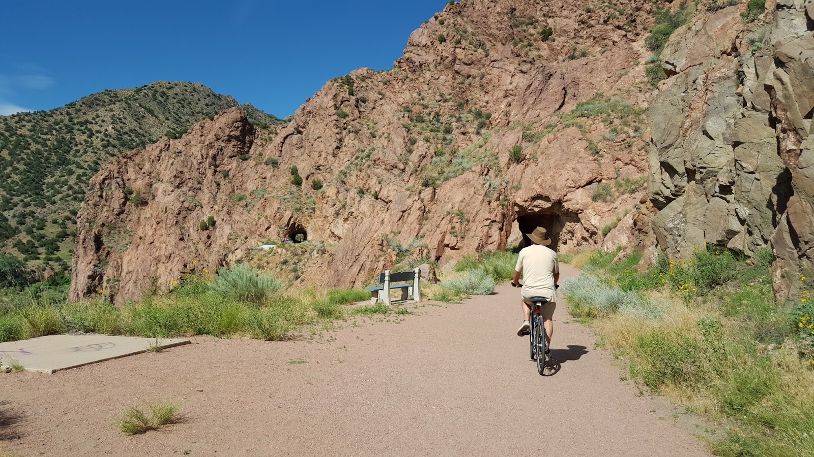
Canon City has a couple of "Rail to Trails" bike paths.  We selected a cooler day to try out these bike trails.  This section is called "Tunnel Drive Trail".  It was a bit scary for me as the path rode along the side of the mountain..just as the old train did in the 1890's. Click here to learn more about the history of the Royal Gorge Railroad.


There are 3 tunnels along the bike trail.  This is the longest one, around 250 feet long.

The terrain was very desert-like with cactus, juniper and a few pinion trees.

There are 3 trestle bridges too.  This is the last one and the trail goes downhill from it, ending shortly afterwards.  We turned around after we crossed that last trestle.
Then we rode our bikes on the Canon City Riverwalk.
The trail is flat and convenient, right beside the Arkansas River. It was a cool ride with a tree-lined path, very opposite in comparison to the open, desert-like, side of a mountain Tunnel Drive Trail.
This take out area along the Riverwalk is used frequently by kayakers and rafters.  Canon City also has a Whitewater Festival in June.
We didn't bike the entire 7 miles of the Riverwalk Trail. We had just ridden the Tunnel Drive Trail and we were give out!

We have experienced some tasty meals while here in the Canon City area.
                               Here are a few that stood out.                                       
Pizza Madness in Canon City: MeatLovers/ Colorado Chicken
Rudy's BBQ Chicken and BBQ turkey with Baked Beans in Colorado Springs
                                                                     
Look at the size of those Meatballs!  Rosario's at the Pueblo Riverwalk

We discovered
They have only one menu item: great steaks.


We celebrated our 31st anniversary at Michael's On Main with baked salmon & candied ginger/raspberry sauce. Outstanding!

We frequently see the magpies here too.  I always think of the funny Windex commercial when I see Magpies!


More later of our "Colorado Livin" experiences as we Eas-On Down The Road to Pagosa Springs.

Saturday, July 25, 2015

Monarch Pass = 11,312 ft

We tried to choose the clearest day of the week for our drive up to Monarch Pass.  On this day trip, we had good weather, saw fantastic mountain scenery and enjoyed a tasty lunch in Salida too.

  From Canon City, we traveled west on US Hwy 50 through Salida, to reach the Monarch Pass area.

The views of the Rocky Mountains are especially clear on this day even though the clouds started to build.


With our tummies full, we're ready to continue our trip.  Highway 50 West passes by the old Madonna mine.  Ore containing silver and lead was mined here.  It's also listed as part of an old  Colorado ghost town.


 Ron notices in his rear view mirror, coming up fast behind us in the passing lane, a Ferrari, 3 Porches, a Jaguar F-type and a Lamborghini.  He tried to catch up with them in our Jeep..didn't happen.  We finally caught up with them at the road construction stop.  We think they were all traveling together.  What a collection of sports cars!
Traveling westbound towards Monarch Pass, it is a 6% grade for approximately 10 miles. 


We make it to the summit of Monarch Pass and the Continental Divide.
Out goal is to also ride the Monarch Pass Tramway.

The gondola ride was smooth and even a bit of fun.  Once we arrived to the enclosed viewing platform on the summit, the scenery was just spectacular!

Monarch Summit..12,000 feet and the temperature was 53 degrees with a 25 mph breeze..gusts to 35 mph.


The enclosed viewing platform also has a walkway around it for easy 360 views.  Inside there are visuals that describe all five mountain ranges.
Pikes Peak is visible this day yet it's hard to note in this photograph.
                         Mount Ouray is the far mountain on the right.

Mount Aetna is the far mountain on the left. 
There were a variety alpine wildflowers on the summit.

I think this alpine wildflower is called Sky Pilot.
Our views during the gondola ride back down to the parking lot.

More views from the gondola.


Our drive back to Canon City on US Hwy 50 East travels through the Bighorn Sheep Canyon. 
Again, a terrific road for more gorge scenery and whitewater rafting as the road follows the Arkansas River.
We enjoy traveling this road to get to the town of Westcliffe too.


Ron spotted a family of Rocky Mountain Bighorn Sheep as we traveled through the canyon this day.  I had just enough camera battery left to capture one up close with the telephoto lens.


And this is what Little Boy does while we are out exploring Colorado.


More later.