Ronnie and I have had Death Valley National Park on our list to visit for a long time. During our working years, our camping travels only took place during summers therefore we wouldn't visit such extreme hot places. You can come to Death Valley in the summer but you have to be prepared for daytime high temperatures of 100 degrees or more. As we moved southward from our time on the Oregon coast, staying in Bend for a few days, Ronnie checked the weather for Death Valley and it appeared that we just might have a good cool weather window to visit this surreal landscape. The drive from Bend, Oregon to Pahrump, Nevada took us on Highway 395 to Highway 95 towards Tonapah, Nevada. We continued further southward on Highway 95 (through Hawthorne, the largest ammunition storage facility in the world) to Highway 160 and arrived to the nice Wine Ridge RV Park in Pahrump. This was our base camp to visit Death Valley National Park and even get in a day trip to Las Vegas. A cold front while here even brought snow to the Spring Mountains seen behind our campground.


We discovered so much to see and explore in Death Valley National Park! After our first day trip we would need an extra day to view more of this amazing place. We extended our time in Pahrump and made another trip back to the National Park. And we still missed several car hikes, 4x4 wheel roads plus several other interesting natural landmarks. Here's a condensed version of our time in Death Valley, a place of intriguing history and landscapes of intense textures, patterns and colors.
 |
| Welcome sign on Highway 190, a the short cut to the Park from Pahrump. A carload of tourists from Georgia emptied as we did, one offered to take our photo. |
To Learn more about Death Valley National Park, click HERE and HERE.
The blog title "Death Valley Days" refers to the 1952-1970 American western TV program of the same name. To learn more about that TV series, which some scenes were filmed in Death Valley (as well as many other movies and TV shows) click HERE.
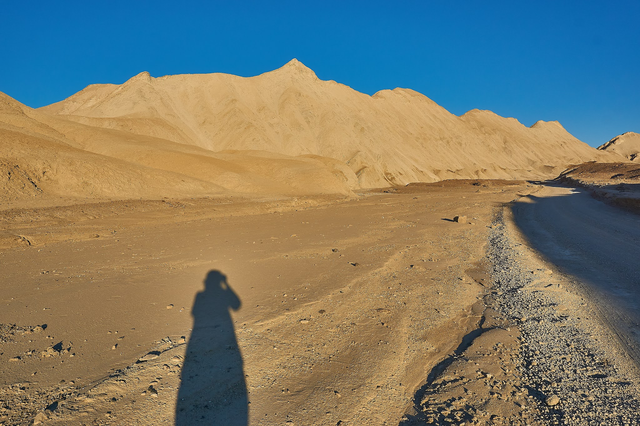
Driving into the Park, our first scenic viewpoint was Zabriskie Point. This section reminded us a lot of the South Dakota Badlands where land erosion created colorful golden-brown mudstone hills. Sunsets and sunrises are popular photography times here and fortunately we had an opportunity to make a second stop for a late afternoon snapshot. We could see how the sunlight did change the sand colors.
 |
| A mid day photograph. |
 |
| Deeper shadows and colors can be seen about 2 hours before sunset. |
This particular vista was popular with several other tourists, the most we saw this day.


 |
| Late afternoon view at Zabriskie Point. |


The road through Death Valley seems to stretch out for miles and miles. We made the decision to visit the charcoal kilns on the Emigrant Canyon Road. This trip will take us through the heart of Death Valley National Park.


Following the Emigrant Canyon Road for about 21 miles, we finally reached the charcoal kilns. These structures were built in 1877 to burn/smoke juniper wood to make charcoal. This charcoal was used to smelt the nearby mined silver ore. These kilns were only used a few years and amazingly remain as they did when left. To learn more about the history of mining in Death Valley and the charcoal kilns click HERE.

When you walk inside one, you can still see the smut and smell the odor of burnt wood.


 |
| Orange sulphor butterfly |
 |
| Painted lady butterfly |


Looking back behind the Jeep, the hills have muted colors within the shadows of sunset.


The 'bad water' or salty water pooled near the boardwalk.

The white arrow to the right designates the "Sea Level" sign seen on the canyon rock wall.

The polygon salt formations of the salt flats. Look closely, you can see two tourists on the horizon.

Ronnie scanning the rock cliff wall for the Sea Level signage.

Close view of the salt crystals. Kneeling to take a floor view photograph of the salt flats was done quickly, those salt crystals are sharp.


Once again, we were offered a photograph of us in this historic landscape. Sure.

We were intrigued with Death Valley's "Devil's Golf Course". Here the salt flats have eroded and reshaped into sharp mounds of salty rock. Rising salt water formed crystals then windblown into these large rocky boulders, this landscape was as harsh as it could get. Signage warned of walking out into this landscape too far as severe cuts and possible broken bones could result!


Back on the main road, we came upon another side paved road, the "Artists Palette Drive". Once more, scenic views surrounded us on that high desert drive.

Salt flats can be seen in the 'Death Valley' below.

The Artist Palette area is one of the most photographed scenic spots in Death Valley National Park. The volcanic deposited iron oxides and chlorite created a variegated display of color and texture. We visited during the mid-day therefore our color view was a little 'sun washed out' but still impressive.

Ronnie standing on the hillside in the foreground, notice the tiny hikers, center, perched on a distant hillside trail.

The blue sky again contrasts with the orange-brown hills.

One more stop to check out the most popular hike in Death Valley: The Golden Canyon. It's too late in the day for us to make this journey but we did make a short walk into the canyon to get a feel for the environment.


We saved the best view for last: a sunset drive up to Dantes View. Also billed a 'must-see' in Death Valley National Park, this mountain top lookout point rests near the top of Coffin Peak at 5475 feet. The view below of Death Valley, the Badwater Basin Salt Flats and the elongated mountain ranges, projects a view unlike any other. This was a good place to see how Death Valley was geologically created, the two north-south fault lines and the sunken expanse of rock lying between these parallel uplifted mountain ranges/faults. To learn more about the geology of Dantes View click HERE.


No comments:
Post a Comment