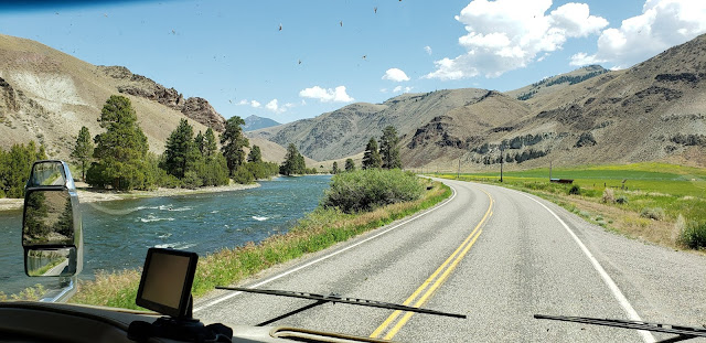
Traveling Hwy 93 northward from Arco, Idaho to Missoula, Montana was one of the most scenic drives we've experienced. This two lane road travels through the Salmon River Valley. It was a mostly curvy road as it followed the river through mountain ranges, fertile, green valleys and desert hillsides. Labeled the Salmon River Scenic Byway, this section of Hwy 93 even runs along portions of the Lewis and Clark Trail. Here are just a few photo highlights I made while peering out our motorhome windshield. Please excuse the bug spatters.
 | ||
| The road begins fairly straight and somewhat flat. |
Here Hwy 93 is entering a narrow rocky gorge and the road seems to disappear into the rocks. At the time we didn't realize we would get this view a few more times.
We enjoyed many windshield views like this one, green irrigated valleys surrounded by high, rocky mountain ranges. This day's drive was about a 230 mile trek. We made several rest stops along the way but with averaging about 45 miles an hour to navigate all those curves, it made for a very long day for Ronnie.
Ronnie was pretty tired after this exhausting day's drive. The road was almost all curves with very few straight stretches of highway, many of them somewhat narrow. We had many views like this one where the road just seemed to disappear into the rocks.
This section of Hwy 93 displayed a mostly a dry, rocky landscape.
Evidence of hay field irrigation here.
Again, the road seemed to curve and disappear into the dry mountainside.
Highway 93 continued to follow along the Salmon River. We traveled through several small towns and communities like Challis and Salmon, however I only made pictures of the interesting landscape of towering hillsides and surrounding mountains.
The thunder clouds gathered and a small sprinkle of rain fell. Unfortunately it was not enough to wash the bugs off the windshield.
After a long hill climb up into the Bitterroot Mountain Range, we reached the Idaho/Montana border. We were at 6995ft at the Lost Trail Pass, named for where Lewis and Clark crossed the Bitterroot Divide in 1805. At the Lost Trail Powder Mountain Ski Rest Area, the beargrass was in full bloom that day.
Descending down the mountain, we entered the Bitterroot Valley and the highway leveled out to flat terrain. The next five nights, we lucked out with a riverside campsite at River Edge Campground just west of Missoula. From our campsite we saw osprey, eagles, deer and the freight train as it followed the Clark Fork River.
We spent a day exploring Petty Creek Road up to the Jack Saloon and Restaurant, a day exploring downtown Missoula and also gearing up for our upcoming time in Glacier National Park.
 |
| The Jack Saloon, built in 1972-73, has an unusual history. Notice the three hefty cedar logs that make up the side walls. |
 |
| The building was made around that one huge cedar log that makes the bar. |
We also came across this large herd of Big Horn Sheep on the Petty Creek Road, sheep were everywhere.


No comments:
Post a Comment